3/29/2013

What happened in Bakony?

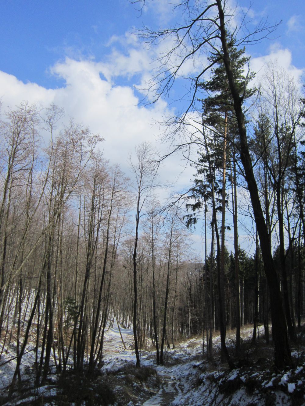
-3°C, chilly wind, overcast sky, muddy roads, huge meadows, and the unique scent of growing wood garlic. It’s high time I shared my experiences about Bakony with you!

In my previous post I was complaining about bad weather conditions and the lack of hiking companions. To tell you the truth I was thoughtless. I made it on Saturday and two of my friends joined me. Success!


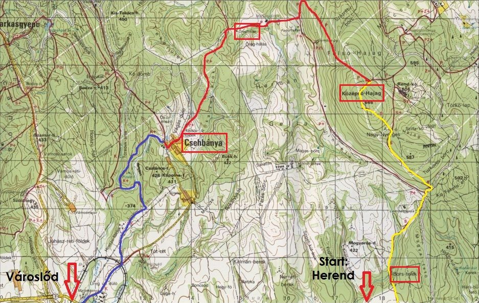
Let’s start from the beginning. I always write the “how to get there” part in my posts; however, I don’t give you instructions about where to find Hungarian bus or railway schedule. Problem solved! In the sidebar of the blog (under the slideshow) you can find both of them. Click on the links; the websites are in English.  

This time, we took a bus to Herend, but it was crowded and slow. If you take my advice, you would rather go by train. Taking a bus was also disadvantageous, because the first trail we went on with the guys started from the railway station, so we had to cross the village, looking for the proper way. But that’s a feature of hiking, right?

Contrast

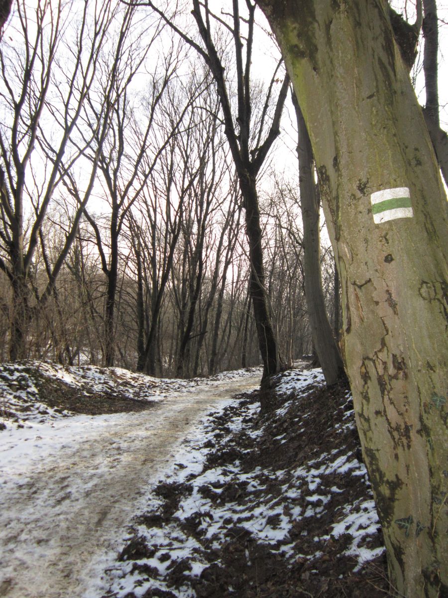
Bakony is a quite big mountainous region in Hungary, so you can hike in it for days. We didn’t have that much time, so we did a 26km hike. We set off from Herend and arrived to Városlőd via Csehbánya (Ger: Böhmischhütten) which is a small village with less than 300 inhabitants. It was like a ghost town; silent, motionless. The weather was chilly, but I didn’t expect any snow. Unfortunately there were snowy trails and areas covered by blanket of snow. Nature was still asleep. (Spring, where are you?)


What's your impression?


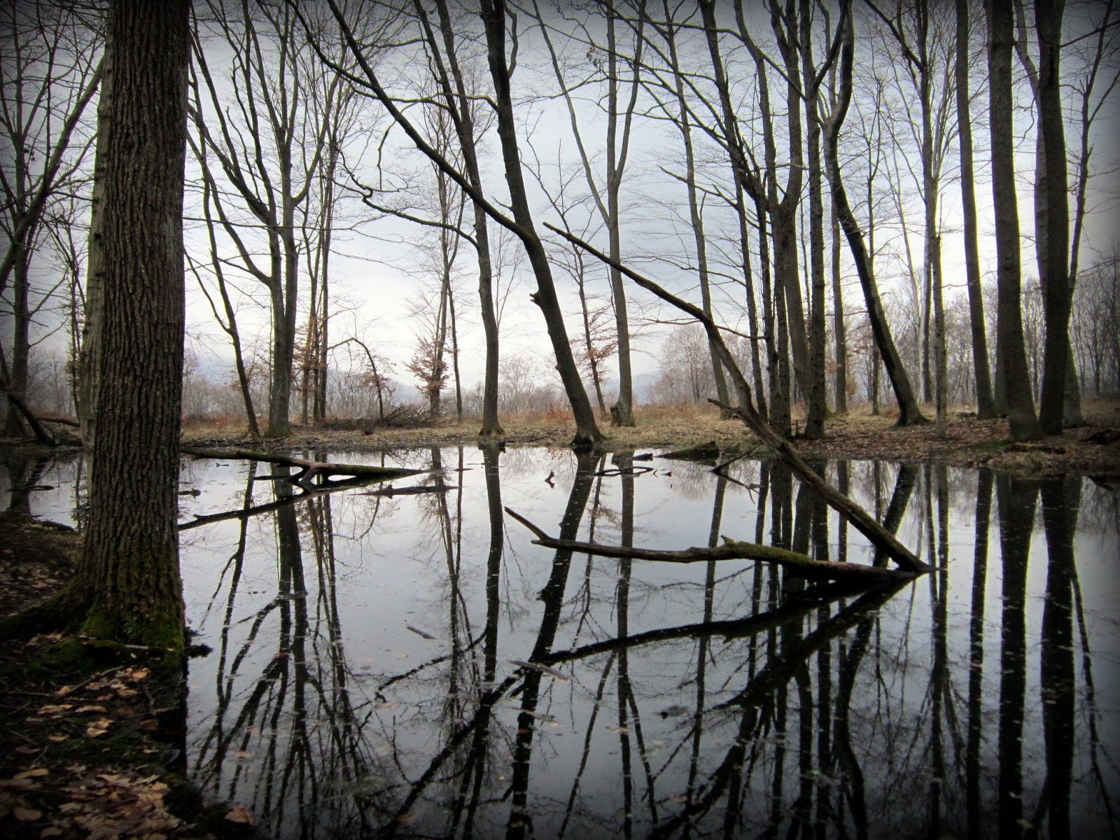
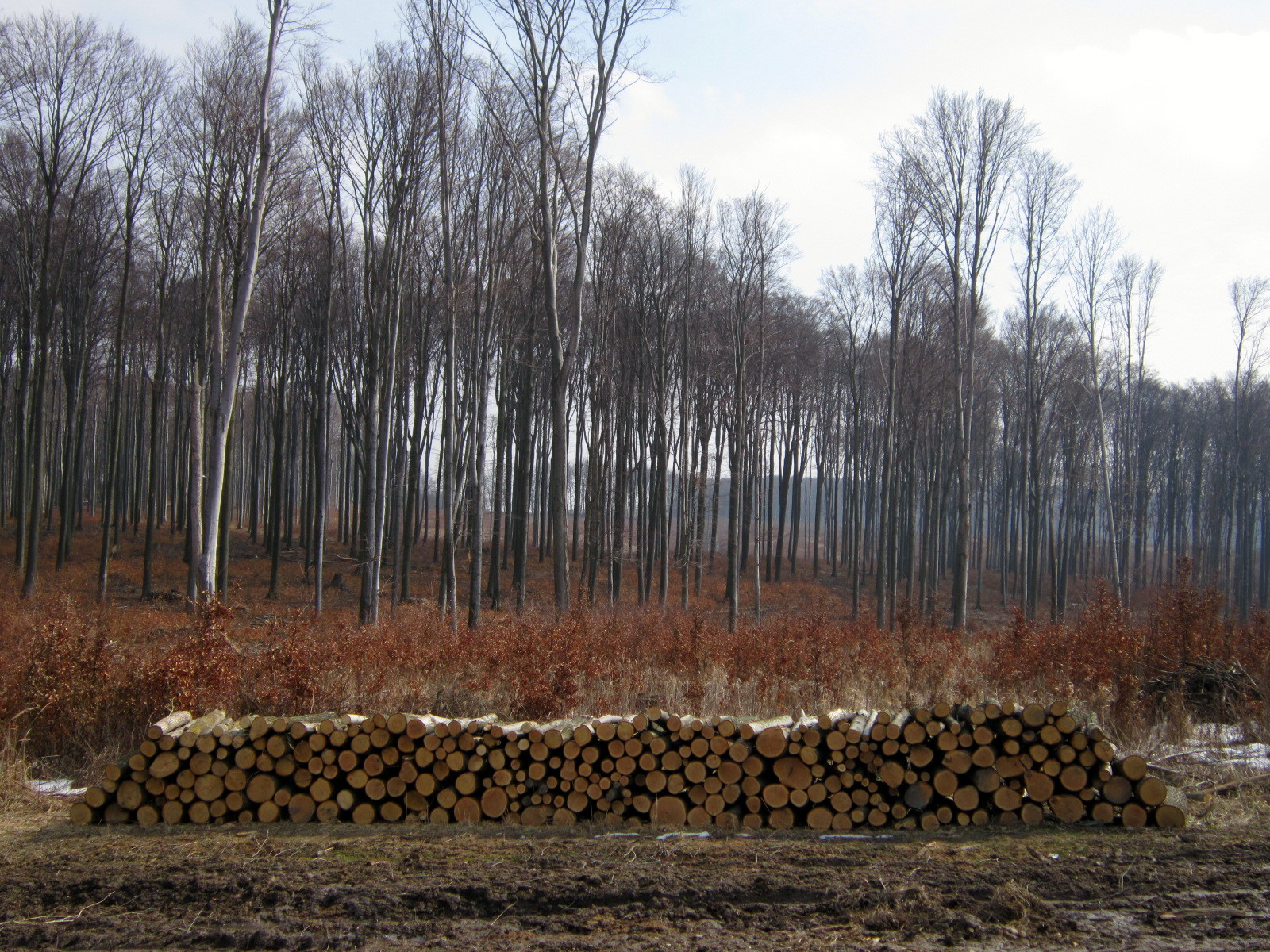
We were halfway on the trail when we ended up on a deforestation area where workers left only some slender trees. This big open space seemed strange to me, but there was something beautiful in it.


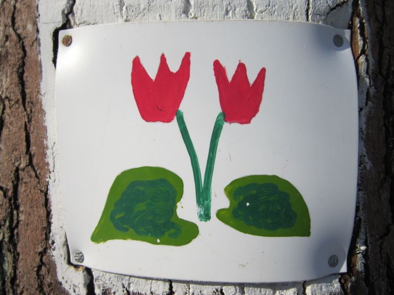
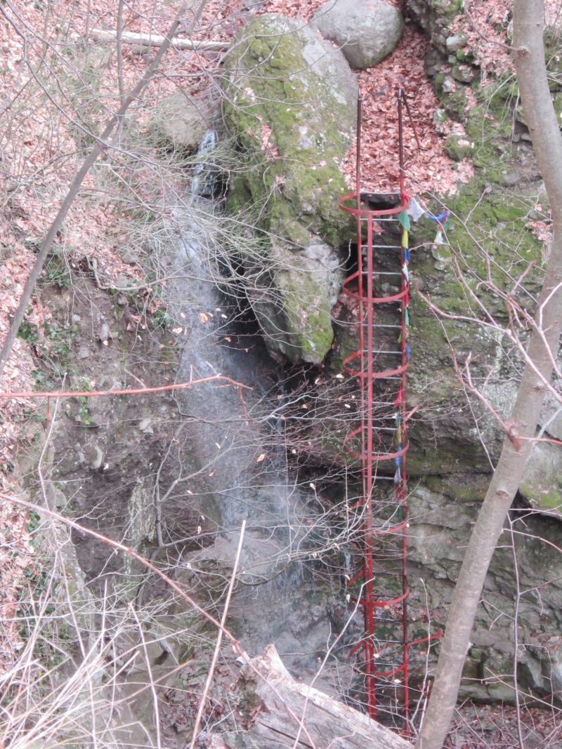
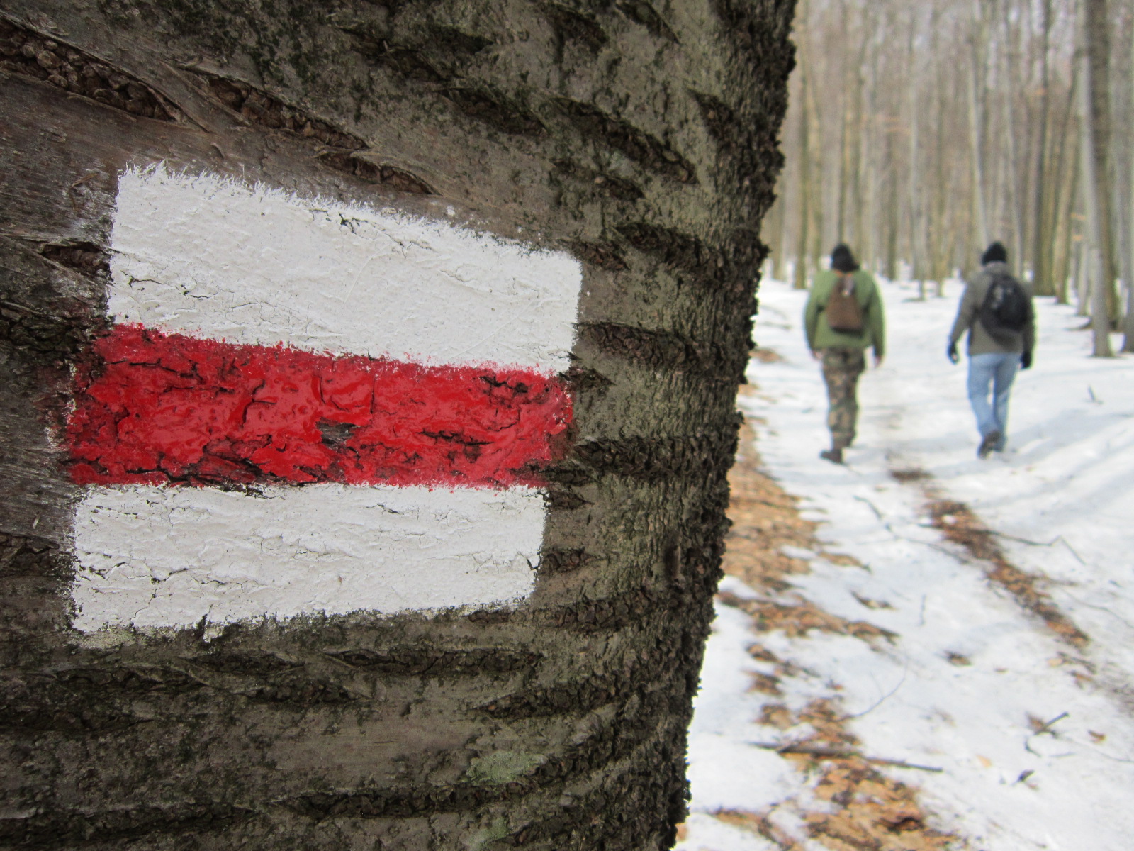
Another spectacular part was the valley of Torna-creek. We had to cross riffles several times and this made the hike more exciting and demanding, since the valley was the last part of the hike. Additional info: it is easy to get lost in this hike… Some hiking signs are missing because of the recent deforestation. Bakony is beautiful, but it could have been more colorful when we visited it. 
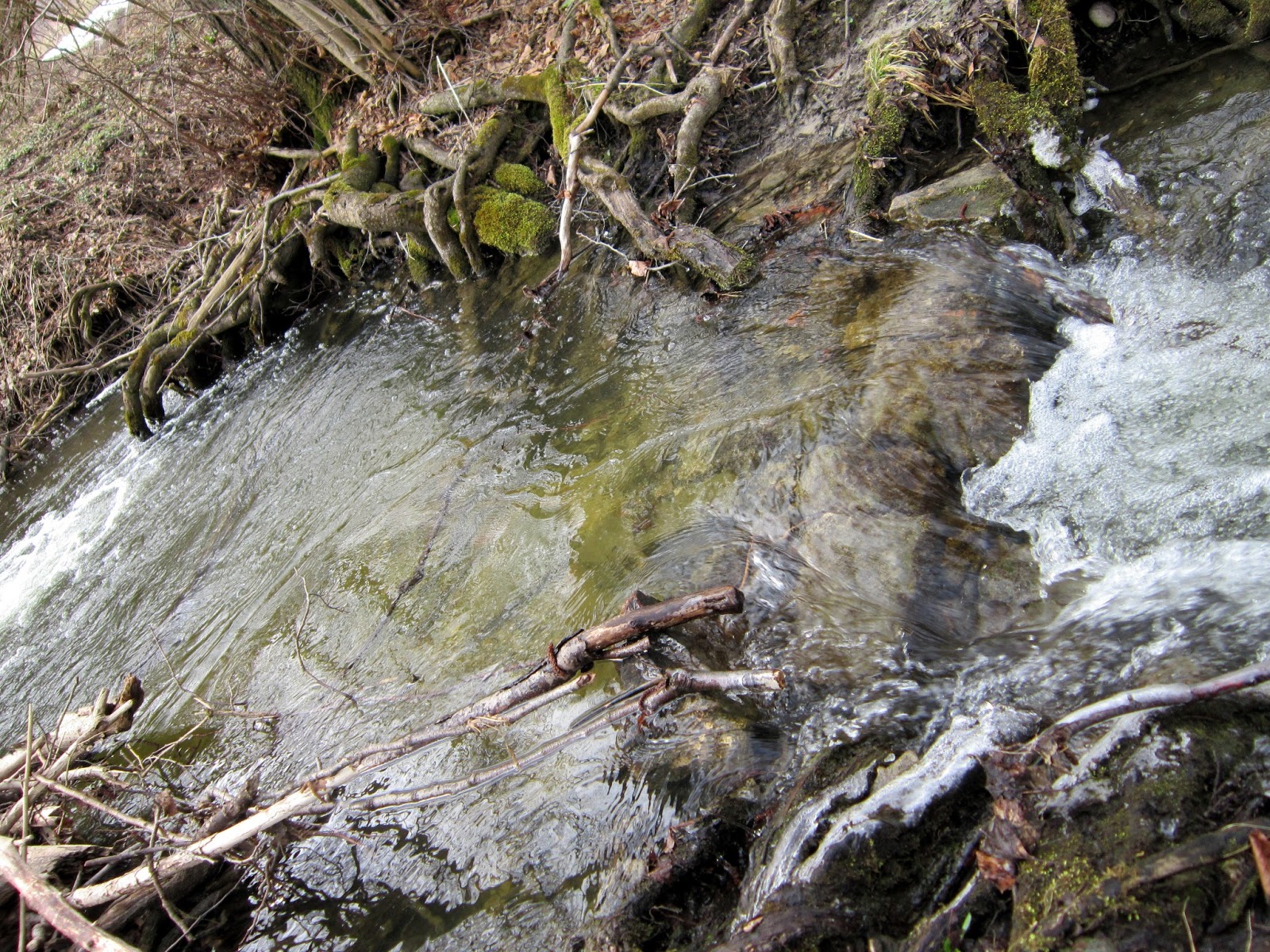
Torna-creek
I am really looking forward to spring, maybe it brings less rain and more sunshine.

3/21/2013

Visiting Bakony this Weekend


Bakony, located in Veszprém county, is a mountainous region and the largest part of Transdanubian Mountains. Although, it’s raining cats and dogs right now, the hope dies last, you know… I hope I can make it Saturday. I’ve found a 25 km long trail; the elevation is 450 m. I’ll approach the start from Budapest and set off from Herend railway station at about 9 AM. The destination is Városlőd. If you would like to join, contact me. Originally, I have two companions but presumably, they will back off. (I understand their reasons, not everyone is a fanatic)...  Stay tuned! 

This would be the trail

3/17/2013

Short Hike Near Sopron


This weekend in Hungary is longer than usual; Friday, March 15 is our national holiday, (no school or work) so I decided to travel back to my beautiful hometown from the hectic Budapest. It should be spring yet; however, the weather conditions don’t show this. As BBC wrote online, Hungarian army „uses tanks to reach snowbound motorists”. It proves that the situation in some areas is pretty tough. I travelled by train on Thursday and managed to arrive only a bit more than one hour late. I was lucky, right? 

Today, the weather is beautiful, though. -Few clouds, blue sky, and warm sunshine- Therefore, I went along a trail which caught my attention years before. It is the Cyclamen-educational path. This hike is absolutely an easy-peasy one. It is self-guiding and contains 12 major and several minor explanatory notices. You just simply can’t get lost. I strongly recommend this one for beginner hikers and for those who spend only some days in Sopron and their agenda is very strict.  (Yeah, the city has pretty much things to show you – decide in advance, what you would like to do/see). 

Sign of the trail

Let’s see what this hike offers to us! Since it is an educational path, you can find explanatory notices near the trail, informing you about the type of soil, flora, and fauna of the Sopron-Forest Park. Here are some species of the fauna you may see, while visiting this area: (Rana temporaria) European Common Frog; (Dendrocopos major) Great Spotted Woodpecker; (Turdus philomelos) Song Thrush; (Sitta europaea) Eurasian Nuthatch; (Lucanus cervus) Stag beetle. The flora is also rich in species: (Larix decidua) European Larch, (Salix caprea) Goat Willow, (Quercus petraea) Sessile Oak, and of course the (Cyclamen purpurascens) Purple Cyclamen which is the eponym plant of this trail. 

The road lies ahead

The length is 8,600 m. You can go along this path at a comfortable pace (~3 hours). Both the start (Hotel Lővér) and the end (Kertváros - Bánfalva) of the route is located close to a bus stop, so you can easily approach the Cyclamen-trail and go downtown after finishing the hike. Take bus number 1 or 2 to reach the start and bus number 3 or 10 at the end of the trip. (A single ticket costs 390HUF in Sopron) The terrain is viable but some parts of it tend to be sludgy, especially in this part of the year. Although it is an easy hike, wear stable, waterproof boots.

Map

Not only the wildlife and the flora are spectacular in this region, but you can find an amazing lookout turret close to the end of the hike. It is built upon one of the highest points of Sopron-Mountains (482m). You can have a longer rest there and it is absolutely worth climbing up. The place itself is called Várhely (Burgstall), because in the Early Iron Age (Hallstatt Period 750-400 BC.) there stood a hill fort built by Celtic tribes, fortified with ramparts. These ramparts are still visible, plus you can see several ancient tumuli. If you are both a history and hiking fan, then you will enjoy this part the most (the explanatory notices will tell you more about the systematic excavations and archeological processes).

A Celtic tumulus covered by snow

One of my favourite spots...
Okay, let’s deal with the turret. The panorama from the tower can be breathtaking if the weather is clear. You can see Sopron and the Fertő-lake behind the city. The silhouette of beautiful Schneeberg Mountain is also visible. 

Fluffy clouds - spectacular panorama
All in all, this is a pleasant hike which makes you familiar with the Sopron-Forest Park. Don’t miss it if you are looking for a good hiking experience! 

3/10/2013

24 km at Pilis Mountains

6 AM, my alarm goes off. It’s time to wake up, then have some bits of breakfast, check my equipment again, and go to Batthyány tér where my adventure for this weekend starts. Let’s roll.

In spite of the bad, foggy weather, I went outdoors again. (Who would sit in a dark dormitory room, writing assignments all day?) Let me mention that March 15 is coming; that day is one of Hungary’s three national holidays. In memory of the heroes of the 1848-49 Hungarian revolution, Pomáz based Scout troop 937 organized a hike at Pilis Mountains to pay a tribute to this historic event. There were three distances: 12/24/48 km. I decided to enter for the 24 km. There was an opportunity for preliminary application which was a pleasant surprise for me. 


The start was located at Szentendre, close to the final station of suburban railway H5. This spot is so easy to approach, because at weekends trains depart from Batthyány square every 20 minutes. It takes ~40 minutes to get there and the journey is not boring because you can see some sights of Aquincum, a part of Budapest established by the Romans. After arriving there, I saw a long queue; hikers were preparing themselves for the big challenge. The entrance fee was 700HUF, but those who applied beforehand only had to pay 500HUF. At the start I got my itinerary. It was nicely created: there was a perspicuous map in it and the most important details about the hike (time limit, distance and elevation from a checkpoint to another).  

To the memory of Hun. revolution
The first track, leading to Kő-hegy (checkpoint 1) was 5,5 km long. It is not necessary to write too much about it. The weather was still damp and the light conditions were not good enough to take proper photos. I just finished this part quickly. In the checkpoint, I was given some chocolate and a signet to my itinerary. 


Checkpoint 1
During the way to Lajos-forrás, (that’s a spring, visited by local people often) where the second checkpoint was located, every step was a torment. The trails were so muddy that my boots almost stuck in the dirt. Anyway, the fresh spring water recompensed me. 

Refreshing spring-water
The hike was simple so far. Participants only had to follow one trail (simply the yellow). After the third checkpoint, things became more complicated.  There were sections where we had to look for multiple hiking signals and deforestation made barriers through the road. I rarely see heap of logs this high. 


Huge Logs
No doubt the most spectacular part of the whole hike was the Holdvilág árok. It is a spectacular trench deepened by the huge amount of plunging storm-water. It is definitely worth visiting! You can go through the ditch safely, because there are ladders, staircases, and ropes installed on the surface of rocks. A small brook runs through the trench, but be careful after rainy days, because it may swell to a hard
flowing river! 

Climb up!
The last track was ordinary; however, Holdvilág árok was so memorable that I was thinking of it even the way home. There is one extra thing to mention at the end, though. At the finish we were not given only the regular certificate of merit and the unique badge of the event, but some bread and dripping with red onion and mixed pickles. Tea and other beverages were also served, so participants had the opportunity to get to know each other better and recharge their batteries after 24 km of walking.

Hungry hiker's dream...
All in all, the hike was well organized; the route was exciting, demanding, and spectacular. Especially Holdvilág árok [this means “Moonlight trench”] amazed me. Catering was also included. Not bad for 700/500HUF, right? Thank you scouts of Pomáz! We’ll meet next year again, I guess.

Calm pond in the woods

3/03/2013

Green 20 / Zöld 20

What does this strange title mean? Let me explain it to you. On February 16, I was hiking in Buda-hills and tried something completely new. Hiking has a special branch in which one must go through a certain trail, selected by the organizers of the event, and reach the goal within a time limit. Besides, if you would like to be qualified at the finish, you need to get a seal put on your itinerary (a document you receive at the start) at every checkpoint. The aim of this whole event is to increase the strength and endurance of the participants. However, it has a special mood as if it were some kind of race.

Ideal spot for shooting panoramas.
It may seem complicated, but basically it is not. I have heard about hikes like this, but you know, I would rather hike alone or with some friends and I don’t pay attention to time limit or anything like that. Still, for some reason I was curious, looked it up and became interested. In Hungary, this type of hiking is so popular that you can find 2 or 3 hiking opportunities, organized by the association of Teljesítménytúrázók, every weekend in different regions of the country. Find the detailed calendar of hikes here!

Look for this sign!
Oh right, back to the Green 20. It is called like this, because participants must go on the green trail (see some info about basic Hungarian hiking signs below) and the distance is 20 km. The start was at Normafa, and the destination was Solymár. Take bus 21/21A at Széll Kálmán tér, Budapest and travel until Normafa station. The bus stops right in front of the pub in which you need to register.  The entry fee was 600HUF. If you would like to participate you need to pay this fee. In exchange for it, you get your itinerary, a brochure which contains a photocopied map of the area and a detailed description of the trail from checkpoint to checkpoint. If you don’t run out of time and reached the checkpoints in the specified sequence, you get a badge and a document which proves that you successfully completed the route.   

Here you can see the height difference between checkpoints. The start and the Árpád-lookout turret is highlighted.


You can see eleven checkpoints in the map because the Green 30 / 45 was organized for the same day. People who sign up to the 20 only need to complete 7 checkpoints.

Finally, here are some advices. Don’t try this hike if you are looking for a pleasant outdoor activity. It is kind of tough. Hardly had you reached a checkpoint you need to ask for the seal and continue your trip. There isn’t too much time to take photos, eat, and relax, you need to hurry and check the time again and again. Always wear waterproof and durable boots. If you are already have some experiences in hiking then don’t hesitate to participate in one like the Green 20!

Collect the signets in this document during the hike!